

Features Wanderfreund
Wanderfreund is a complete guide for long-distance hikes in Germany.
Wanderfreund provides all of the features you need as a "thru-hiker" on Germanys multitude of beautiful trails.
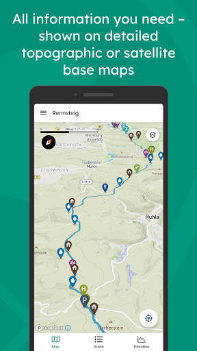
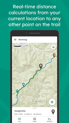
Wanderfreund’s highlighted features include:- Professionally collected route information including tracks, elevation profile, and thousands of waypoints.- Waypoints include detailed descriptions and photos for huts, water sources, cities/towns, transportation, and more.- Real-time calculations provide actual walking distance between you and your destination.- Live and interactive elevation profile that shows your elevation alongside the elevation of the waypoints you are headed to.- Detailed map layers.- Full-functionality offline: you can pre-download waypoint details, photos, and map layers for use away from mobile service.- Access to an interactive community of hikers that share live information and updates about waypoint and trail conditions via vibrant in-app commenting.- Trail guides offered: Rennsteig, Westweg, Hochrhöner, Weserberglandweg, Harzer Hexenstieg, Altmühltal Panoramaweg, Kammweg Erzgebirge-Vogtland, and many more on the way!
Social Features
Connect and share with friends and the community.
Camera Features
Advanced camera features with editing capabilities.
Food & Dining
Discover recipes and order food from your favorite restaurants.
See the Wanderfreund in Action
Get the App Today
Available for Android 8.0 and above